

EasyFlood integrates climate data and coastal archetypes to design optimal flood modeling strategies. These components are combined into an open-source framework and tool suite, allowing users to easily simulate coastal flooding and implement effective adaptation measures
WP1. DataHub
Collection of required databases, including historical climate drivers, climate change projections, topo-bathymetric data, and land uses.
O.2 Catalog of Archetypes
Literature review, analysis, and geometric parameterization of the most relevant morphological units and forcings for coastal flooding.
O.3 Adaptation Measures
Creation of a catalog of structural, technological, and ecosystem-based measures (nature-based solutions), alongside an optimization methodology using Dynamic Adaptation Policy Pathways (DAPPs).
O4. EasyFlood Tools Suite
Integration of statistical tools (such as the BlueMath library), numerical models (e.g., Delft3D-FLOW-FM, SCHISM, SWASH), and optimization methods
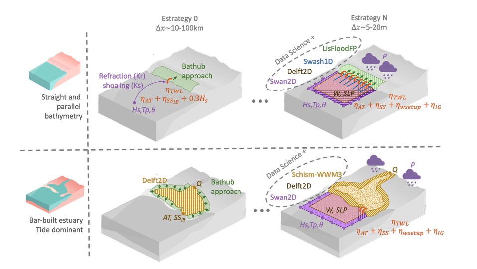
O5. Modelling Strategies
Design of a flooding modelling inventory based on constraints like the specific coastal archetype, data quality, and available computational resources
O.6 Orchestrator Framework
Development of a web front-end aggregating the tools into Jupyter Notebooks, designed to leverage distributed environments like clusters or Cloud
O.6 Dissemination
Actions to ensure the accessibility of data and open-source tools to the scientific community, stakeholders, and the general public
«Études nos ha ahorrado miles de horas de trabajo y ha desbloqueado perspectivas que nunca creímos posibles».
Annie Steiner
Director General, Greenprint
Únete a más de 900 suscriptores
Mantente al día de todo lo que necesitas saber.